We remain fully operational. Our teams are working around the clock to ensure your deliveries continue safely.

Descargar la aplicación


Servicios al cliente
Sobre nosotros
Copyright © 2025 Desertcart Holdings Limited
Descargar la aplicación
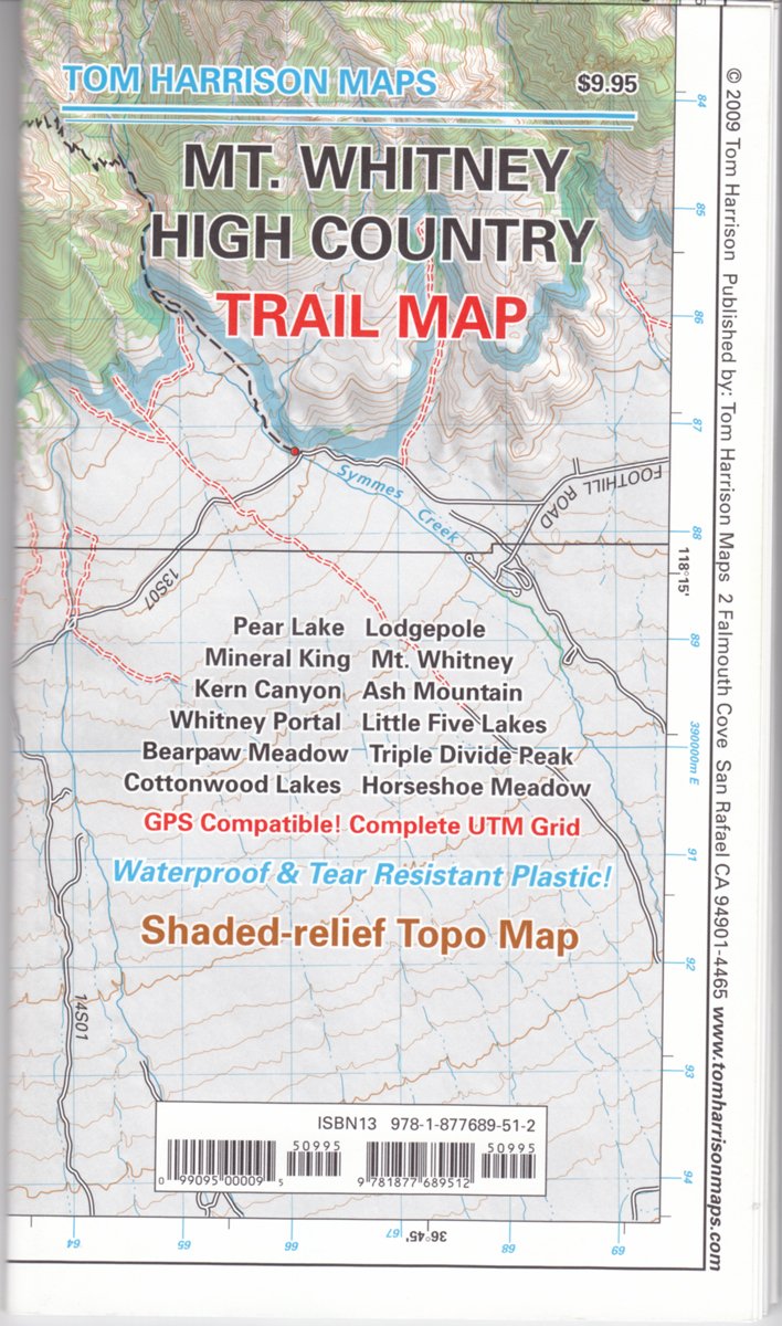
Mt. Whitney High CountryTrail Map (Tom Harrison Maps) [Tom Harrison, Tom Harrison, Tom Harrison] on desertcart.com. *FREE* shipping on qualifying offers. Mt. Whitney High CountryTrail Map (Tom Harrison Maps) Review: Great for planning that backcountry adventure! - The Tom Harrison maps each cover a lot of area and are perfect for planning your backcountry trips. Because of the large areas they cover the detail isn't very close-up so definitely not good for backcountry route finding if doing anything above class 1. If needing a map to navigate by when going cross country then get a USGS map which won't cover as much area but has much better detail. They do work well in conjuction with my gps if I stay on trail though which reduces the # of maps I have to take with me and less is always a good thing when it comes to my backpack weight. They are also waterproof which is pretty much a necessity in my opinion. Very happy with this purchase for what I use it for...trip planning. Review: Best maps - This guy makes the best maps, period, IMO. I have about a dozen of these for various wilderness areas I go backpacking in. Accurate, detailed, and updated often it seems. I have found secondary trails on these that are not included on many other larger maps, which is nice when trying to get off the beaten path. These maps also usually have legend for what type of trail, whether maintained or primitive, etc. Worth every penny when in the backcountry, as they are durable and waterproof.
| Best Sellers Rank | #7,293,062 in Books ( See Top 100 in Books ) |
| Customer Reviews | 4.6 4.6 out of 5 stars (113) |
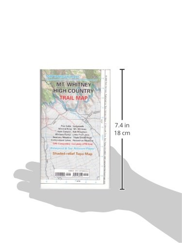
| Dimensions | 4.25 x 0.28 x 7.6 inches |
| Edition | 4th |
| ISBN-10 | 1877689513 |
| ISBN-13 | 978-1877689512 |
| Item Weight | 1.66 ounces |
| Language | English |
| Print length | 1 pages |
| Publication date | February 15, 2018 |
| Publisher | Tom Harrison Maps |
G**Y
Great for planning that backcountry adventure!
The Tom Harrison maps each cover a lot of area and are perfect for planning your backcountry trips. Because of the large areas they cover the detail isn't very close-up so definitely not good for backcountry route finding if doing anything above class 1. If needing a map to navigate by when going cross country then get a USGS map which won't cover as much area but has much better detail. They do work well in conjuction with my gps if I stay on trail though which reduces the # of maps I have to take with me and less is always a good thing when it comes to my backpack weight. They are also waterproof which is pretty much a necessity in my opinion. Very happy with this purchase for what I use it for...trip planning.
C**.
Best maps
This guy makes the best maps, period, IMO. I have about a dozen of these for various wilderness areas I go backpacking in. Accurate, detailed, and updated often it seems. I have found secondary trails on these that are not included on many other larger maps, which is nice when trying to get off the beaten path. These maps also usually have legend for what type of trail, whether maintained or primitive, etc. Worth every penny when in the backcountry, as they are durable and waterproof.
M**S
... map covers all of Sequoia National Park and is perfect for planning and executing a trip across the High ...
This map covers all of Sequoia National Park and is perfect for planning and executing a trip across the High Sierra Trail. The eastern edge includes all of the roads in Sequoia National Park (like Wolverton, Lodgepole, General Sherman Tree), and the western edge includes Mt. Whitney and the Whitney portal.
J**L
This is the map for the High Sierra Trail
Map is printed on durable waterproof material that easily survived a High Sierra trail trip in terrible weather. The map includes detailed and accurate information on the High Sierra trail, and when combined with one of the trail descriptions available from thousands of bloggers, provides everything that an experienced trekker should need to navigate the trail.
L**N
Another good Harrison map
I really like TH maps, and this one is no exception. My only reason for dropping it a star is the fact that the Mt Whitney day hike routes are just a small part of the map...not TH's fault, just a disappointment on my part.
S**Y
A Good Choice
Easy to read, plastic for durability. Took it on 7-day trip on High Sierra Trail. Liked that it had milage between trail junctions and that it had locations of Bear Boxes. I have come to like the Tom Harrison maps better than others.
M**N
Really fantastic map
Used mainly for the High Sierra Trail. Super helpful, especially as trail conditions were poor this year and alternate strategies required. Wouldn't do the HST without it.
C**M
Great for High Sierra trail
I used this map while hiking the High Sierra trail between Crescent Meadow in Sequoia National Park and Mount Whitney. This map can also be used for the end of the John Muir trail at Mount Whitney and that portion of the PCT. Large water resistant foldable map shows all the major points of interest in the High Sierra portion of Sequoia and King's Canyon National parks including elevation and provides a total overview of the topography of the area. Recommend that you keep it safely in a zip bag like a 9"x6" aLoksak.
Trustpilot
Hace 3 días
Hace 1 mes