

🌟 Navigate the Waters Like a Pro!
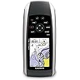
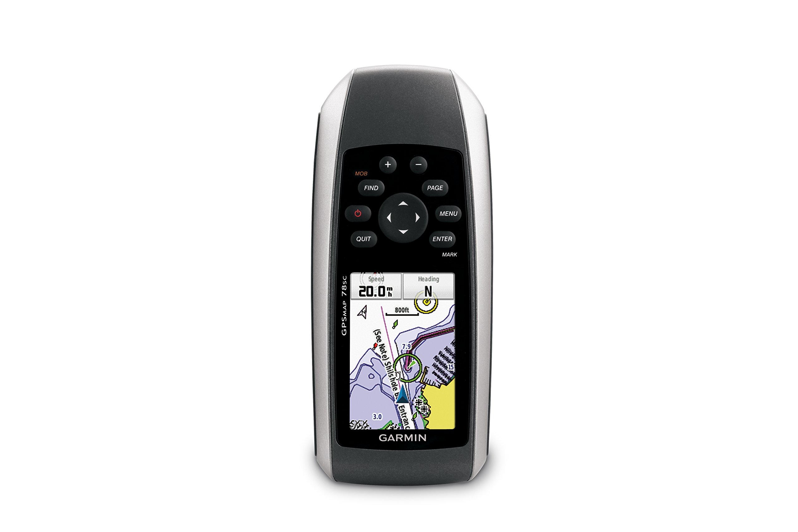
The Garmin GPSMAP 78sc is a robust, marine-friendly handheld GPS and chartplotter, featuring a high-sensitivity GPS receiver, a vibrant 2.6-inch color TFT display, and waterproof capabilities. It comes preloaded with BlueChart g2 coastal charts for the U.S. and Bahamas, and includes advanced navigation tools like a 3-axis electronic compass and barometric altimeter. Perfect for boating and watersports enthusiasts, it also allows for wireless sharing of navigation data.

| Memory Storage Capacity | 1740 MB |
| Display Type | LCD |
| Human-Interface Input | Buttons |
| Compatible Devices | Aegean Sea & Sea of Marmara, Alborg-Amsterdam, Alpine Lakes, Bay of Biscay, Baykal & Novosibirskoe, Benelux Offshore & Inland, Canada, Caspian-Ulyanovsk-Orsk, Denmark East-Sweden Southeast, English Channel, Great Britain, Northeast Coast, Ireland, West Coast, Irish Sea, Italy, Adriatic Sea, Italy Southwest & Tunisia, Mediterranean Southeast, Portugal & Northwest Spain, Scotland, West Coast, S/E UK-Belux Inland Waters, Spain, Mediterranean Coast, Sweden Inland Waters, White Sea |
| Control Method | Voice |
| Are Batteries Included | Yes |
| Supported Satellite Navigation System | GPS |
| Sport Type | Boating |
| Battery Average Life | 20 Hours |
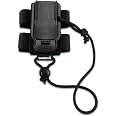
| Mount Type | Wrist Mount, found in image |
| Resolution | 160 x 240 |
| Compatible with Vehicle Type | Boat |
| Screen Size | 2.6 Inches |
| Additional Features | Rugged case, Barometric altimeter, Garmin Connect compatible, Electromagnetic compass, Garmin HotFix, Custom POIs, Automatic routing, Hunt/fish calendar, Geocaching, Photo navigation |
| Connectivity Technology | Bluetooth |
| Map Types | Oceania |
| Item Weight | 7.7 Ounces |
| Item Dimensions L x W x H | 2.6"L x 1.2"W x 6"H |
I**N
Brilliant
Spot on .. Brilliant bit of kit .. Charts seem expensive and lacking in detail ( Turkey ) .. Uk East Coast chart has far more detail .. Bought as backup to onboard system
S**E
Garmin GPSMAP 78s
I purchased this marine gps unit on July 4th 2012 and used it on a trip from Canary Wharf to Harwich and back on an old coal fired steam tug later on that month.I cannot praise it's performance enough being totally accurate at all times and even more useful with the micro SD card containing the Dover to Amsterdam and England Southeast marine chart which I purchased direct from Garmin.It took some time to work through the full instruction manual(downloaded from Garmin)and I had to phone Garmin a couple of times for help which was politely and patiently given.This unit gave great piece of mind during our trip and I would thoroughly recommend it.
S**D
Great piece of equipment
It's got all the functionality needed for sailing, and while resolution/screen definition isn't up to iPad standard, it really is hyper rugged and will take any amount of water, rain, bashing etc.One issue I have had is the unit switching itself off straight after start up, but solved it by performing a master reset: no idea why, so it loses a star.Charts are expensive too.
S**L
Five Stars
Great addition to my 21footer! Very capable little machine! Everything you need inside plus great portability!
A**R
great customer service.
great customer service. super product
D**D
Very Disappointing
Bought this to replace an old Garmin 12 hand held GPS, that was lost when I loaned it to someone. This unit seemed to be a similar product but with updated features. Well I really wish I could have just bought another GPS12 because this update is rubbish. The unit itself when it works, is so slow almost to the point of being useless, when finding some address or POI. Also the software is not very intuitive unlike the previous model, it takes ages trying to go into this menu and that to find the setting you are looking for. I connected this unit to my mac and eventually got it to synch all my waypoints and routes from another Garmin GPS unit I have and now it will not reconnect no matter what I do. The screen is to small to be useful for navigating as you really need to have some fields shown at the top such as distance to next turn and this then takes up so much real estate that the map picture is very hard to see. I also bought the UK road mas and the Marine maps and have been disappointed with these as well. I think i need to send my unit back as it randomly crashes and reboots or just stays off. When it works the software is poorly laid out and takes forever to do things that should be easy. All in all this was a very expensive package and no where near worth the money. If you want to have a car sat nav buy a Tom Tom, and for sailing navigation I certainly do not feel that I can trust this thing to work never mind aid my navigation so it is just as well it is waterproof and floats because I can see this thing getting hurled over the side some day soon.
C**L
Be ware you will need to purchase the charts as well to get the best use out of this!
My parents purchased this for me as my husband and I have just started sailing our own yacht and we needed a handheld plotter as we have no on board electrics. We have never used one of these before so were not sure what to expect. The plotter is useless for marine navigational purposes if you do not buy the Bluechart g2 packs for the area that you are planning on sailing because the basemap is very basic and does not have sufficient information to make it any use from my perspective and these additional charts are expensive (The English Channel chart is currently £165 for the latest version). Therefore you need to bear in mind that although this unit is very robust, well made and has some great features that you will need to buy the charts if you want to use this item for navigation purposes. Therefore if you are new to this like we are then you need to take this into consideration when purchasing this unit as it may not be a cheap as it first appears.
D**O
Good product but slightly complicated menus
I bought this product then added the English Channel sailing map from the Garmin site and I've used the map for various sailing trips in the Solent. I've had no problems with getting a GPS signal and the map has been very accurate. (Lots of other maps are available e.g. for walking.)One or two items on the 78S have been tricky to find in the menu system. I asked for help at the Garmin stand at the boat show and it took three people before getting an answer. Basically even though the screen only shows one option, which is selected by pressing Enter, on some screens pressing Menu can give more options. Simple, but not that obvious when using the 78S.All in all, it's an expensive package but worth the money for piloting in unknown locations and if you don't want to be stuck at the navigation table unaware of what's happening up top.
Trustpilot
Hace 3 semanas
Hace 2 meses