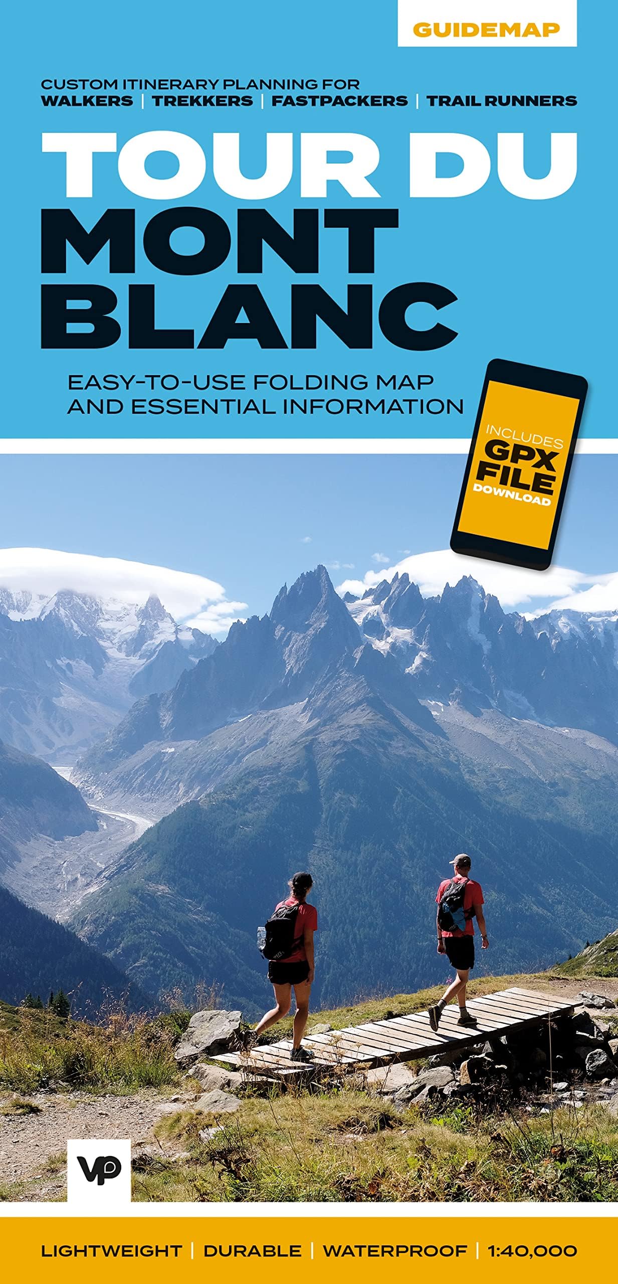
Tour du Mont Blanc: Easy-to-use folding map and essential information, with custom itinerary planning for walkers, trekkers, fastpackers and trail runners (Guidemaps) (Big Trails Guidemaps): 1
Desertcart purchases this item on your behalf and handles shipping, customs, and support to Bolivia.
Description
Tour du Mont Blanc: Easy-to-use folding map and essential information, with custom itinerary planning for walkers, trekkers, fastpackers and trail runners (Guidemaps) (Big Trails Guidemaps): 1
Reviews
D**L
Perfect for the job
Estimated times between refuges depending on speed travelled is great. It also survived some very wet days.
S**Y
Very useful to have all TMB sections on one map, but it's sections not a whole mapr
1:40,000 scale gave more detail than the 1:50k, but the 1:50 is a map of the whole Mt Blanc Massif whereas the 1:40 is just sections so I needed both. It also has loads of other info - timings, accommodation, relief profile etc which was v useful.
C**W
Perfect
Used all the way through my trek
R**.
Essential information to complete the Tour du Mont Blanc in one handy package!
Whilst being somewhat novel, this format of 'guide-map' is ideal for the weight (or clutter) conscious hill user who likes to have all of the essential information for their trip in one place. I particularly like this format of information as it has just about everything you would need to plan ahead and yet adapt your plans on the trail if needed. That’s not to say that the guidebook from the same publisher is superfluous – anything but!A guidebook can obviously provide so much more context and detail to both the planning and enjoyment of your trek but is often best read in the hut or hotel rather than carried every day.I usually spend a lot of the summer trekking season guiding client groups around all or part of the TMB route and have previously used a very small pocket-sized IGN map to initially brief and then give daily updates as to 'where we are & where we have yet to go'. I’m sure that I will now be using this guide-map to do that as well as use the ‘Jones-Ross formula for helping them to estimate how much time they will take for each day’s walk.This guide-map is also a good cost-saving approach as it can replace the 2 x IGN maps + 1 x Italian maps that cover the route in similar detail.The section that gives outline information on route variations is really useful, summarising the outlay in both distance and time that each of these mean – vital when assessing people’s energy and matching that against their expectations.The waterproof and tough ‘paper’ is ideal for folding/squeezing or just shoving into different sized pockets and seems to have worn well in the time used to date.If there were one aspect that I found harder to use it was the information about refuges, huts and camping sites etc. The font size and colour is fine in normal condition but can be harder to read in bright sunlight with/out sunglasses on – a minor glitch in what is otherwise an excellent tool to both plan and carry out your very own Tour du Mont Blanc.
J**E
Packed with info on planning your trip
Really useful Guide map to help plan a Tour of Mont Blanc. A mix between a map and a guide book. This map would be equally useful at the planning stage as on the trail. It suggests itinerary for different speeds from walkers through to runners. It gives detailed accommodation options and is easy to cross reference with the map (although the print size meant I had to use my phone magnifier to read it). There is information on Variations to the route and when appropriate to take them. It is easy to handle (size is smaller than OS) waterproof and ripproof. The mapping clarity is pretty good, especially as it is designed to be used with the GPX file of the route. Kilometre markers on the map are useful on zigzag terrain. It's useful to have emergency info on how to get help easily to hand. I would buy the guide book to do the trip, but it would be buried in the rucksac. This would be out all the time. Overall a great resource, and I would recommend.
C**S
A vital tool to planning your Tour du Mont Blanc Adventure
A hugely informative map with some excellent pieces of information. The most useful piece is the itinerary for different walkers, trekkers, fastpackers and runners. When planning a multi day trip it is always a challenge figuring out where to stop, how much distance / time it will take you. The itinerary planner gives 4 different options to inform you how you should plan your trip, use 1 of the four or mix and match for a customer itinerary. The only improvement I could suggest is a summary of the total distance / ascent / time for each itinerary for each day, for a quick glance of how much one has to do each day. This can be helpful to decide which itinerary to go for and a reminder on the day. I also think a larger version (like in the back cover but this is too small for me to read) so either the back cover turned landscape or a landscape version on the fold when you open it, where the language and currency info is. The information is very useful but if the map is designed to be used in conjunction with a guidebook, drop things like kit lists, mountain safety information and enlarge the scale of the map and give more info on the itinerary sections as I've already said above. A great piece of kit not the less!!!
M**E
Fantastic, clear guide
This is a fantastic, clear map. Lovely clear colours and layout.Great information and I would highly recommend this to anyone interested in, or thinking about visiting this trail.
C**
Concise practical Information
If you like spending hours pouring over a guidebook this will not replace that but if you have done some research and decided the route is for you then this guide map will provide the normal mapping you need along with extra practical route information. Having done the route previously but lost the, I would say the terrain and route variant information is all accurate and well described. The itineraries for walkers, trekkers and trail runners all seem appropriate for distance covered, but this can be adjusted yourself with the formula provided. Sadly won't get used this year but I'll be using it for my next trip...
S**N
My favorite TMB map.
Best feature is the 1 km markers. Map has lots of useful information. Although we found that our actual recorded distances (Garmin GPS) were consistently further than indicated by the kilometer marks, they are very useful for keeping track of your location and progress.
S**K
So convenient, but a little out of date
We absolutely loved having a small map. Everyone else was dragging around these huge books and we definitely got some jealous looks for our all in one option. The only problem was that it was a bit out of date with some main and alternate routes changing so we didn't really know what the official route was at times.
Common Questions
Trustpilot